Cutting-Edge GPS Photo Location App - GPS Photo Location GPS Map
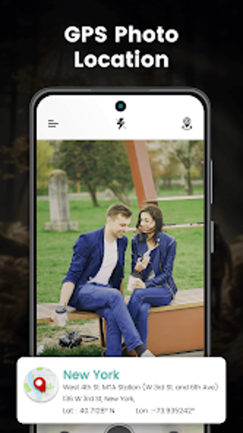
GPS Photo Location GPS Map is a cutting-edge app designed to enhance your photography journey by adding GPS location information to your photos. With this app, you can capture photos and see details such as weather conditions, accurate location, latitude, and longitude.
This app is the perfect companion for both professional photographers and amateur GPS photo location enthusiasts. It allows you to easily capture photos with location history and view detailed information about each photo. The user-friendly interface makes it easy to access real-time GPS photo location and photo timestamps.
In addition, GPS Photo Location GPS Map app provides customization options to enhance your experience. You can easily store and manage your saved GPS map camera photos, making it convenient to organize your memorable memories.
To use this app, you will need to grant permissions for camera access, location tracking, and storage. The camera feature allows you to capture GPS photos, while the location permission enables the app to find your exact location and provide latitude and longitude information instantly. The storage permission is necessary to store the captured images.
Overall, GPS Photo Location GPS Map app is a comprehensive solution for adding geotagging and GPS photo timestamp information to your photos. With its user-friendly interface and useful features, it is a valuable tool for photographers looking to enhance their photography journey with GPS location data.